




Contact Info
- Phone:
- 575-684-2489
Basics
- Length:
- 3.5 miles
- Difficulty:
- Easy,
Intermediate - Time:
- 1.5 hours
- Trailhead Elevation:
- 6920 feet
- Season:
- Spring to Fall
Basic Directions
North on Highway 84 - from Espanola 51 miles; South on Highway 84 - from Taos 89.5 miles; from Chama 39.5 miles. Trail is on the west side of the road. The trail heads at the north end of the guard rail.
Description
At the top of the mesa the trail meets up with Rim Vista Trail. This joining of trails is marked with rock cairns and blue diamond markers on the trees.
Nice walking trail. Trail starts out level and begins a gradual ascent to the top of the mesa at about 1/4 mile into the trail. Vegetation on the trail begins with sagebrush and pinyon-pine and at higher elevations contains ponderosa pine and mixed conifers. Watch out for low-lying cactus. Salazar trail was once an access road used for uranium exploration by mining companies in the late 1960's and early 1970's.
No motorized vehicles or equipment allowed on trail or wilderness area.
Tour Companies
Outspire Hiking and Snowshoeing
- Santa Fe Area
- Snowshoeing, Hiking
- 505-660-0394
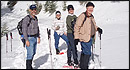 From alpine to desert, Outspire guides enrich your experience by giving context to your hike. So that your destination is not only what you see, but a sense of where the area fits in New Mexico's history, geology and natural world. Our hiking guides are experienced, enthusiastic, and motivated to share the joy of being outside! Day hikes and winter snowshoe outings are planned to suit your interests and fitness.
Helpful Links
Tour Companies
Outspire Hiking and Snowshoeing
- Santa Fe Area
- Snowshoeing, Hiking
- 505-660-0394
Details
Length:
Difficulty:
Intermediate