Contact Info
- Phone:
- 575-587-2255
Basics
- Length:
- 12 miles
- Difficulty:
- Intermediate,
Difficult - Time:
- 8 - 9 hours
- Trailhead Elevation:
- 9200 feet
- Elevation Range:
- 9200 feet to 12300 feet
- Elevation Change:
- 3100 feet
- Usage:
- Heavy
- Season:
- Year Round
Description
As you continue traveling south on Trail 25, the canyon gradually narrows again. The trail crosses to the west side of the river about three miles from the Middle Fork turnoff and the trail begins to ascend high above the river by way of a series of long gentle switchbacks
Chimayosos Peaks dominates the view to the northeast as the trail continues to climb up the canyon. No Fish Lake(11,600') can be seen along the trail just before the final ascent to the Santa Barbara Divide (12,000'). This shallow lake will not support fish since it freezes solid during the winter months. It is located well below the main trail. If you wish to see it be alert and watch for the turn off as you travel up the canyon. Camping is prohibited within 300' of all lakes.
The top of the Divide is located at the saddle between Chimayosos Peak and North Truchas Peak. The trail dropping directly down to the south is the shortest route to the Truchas Lakes. This trail is steep and badly eroded. A better trail, just to the east, switchbacks gradually down to Skyline Trail 251. Turning west along Trail 251 will take you to Truchas Lakes. Turning east will take you along the top of the Santa Barbara Divide.
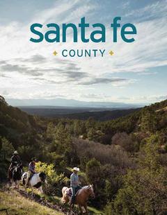
In the summer months the trail is used for hiking and horseback riding. In the Winter he trails are used for cross country skiing and snowshoeing.
Tour Companies
Outspire Hiking and Snowshoeing
- Santa Fe Area
- Snowshoeing, Hiking
- 505-660-0394
Helpful Links
Tour Companies
Outspire Hiking and Snowshoeing
- Santa Fe Area
- Snowshoeing, Hiking
- 505-660-0394
Details
Length:
Difficulty:
Difficult
Time:
Trailhead Elevation:
Elevation Range:
Elevation Change:
Usage:
Season:
Useful Map(s):
Map + Directions
Basic Directions
This is the best maintained and most frequently used of the trails to the Santa Barbara Divide. This trail provides the closest access to the Truchas Lakes from the north. No Fish Lake is located at the base of the Divide. Although the total elevation gains over 3,000 feet, the climb is fairly gradual.
About three miles up the canyon on Trail 24, you will encounter the turnoff to Trail 25. At this point the canyon branches with the Middle Fork and West Fork of the Rio Santa Barbara. The West Fork Trail continues up the canyon which broadens into a large open meadow, where a magnificent array of wild flowers can be seen during July and August.
Cross-country travel into the Pecos Wilderness is becoming more popular with many taking day hikes through the Middle Fork Trail. The terrain will vary along these trails with the most gentle gradient located in the first four to five miles, becoming progressively steeper. Snow depth also increases. South slopes will sometimes have bare spots. Be prepared for adverse weather in the wilderness. Always beware of avalanche!


 From alpine to desert, Outspire guides enrich your experience by giving context to your hike. So that your destination is not only what you see, but a sense of where the area fits in New Mexico's history, geology and natural world. Our hiking guides are experienced, enthusiastic, and motivated to share the joy of being outside! Day hikes and winter snowshoe outings are planned to suit your interests and fitness.


