




Contact Info
Penasco, NM 87553
- Phone:
- 575-587-2255
Basics
- Length:
- 7 miles
- Difficulty:
- Intermediate
- Time:
- 3 - 4 hours
- Trailhead Elevation:
- 10400 feet
- Elevation Range:
- 10300 feet to 10400 feet
- Elevation Change:
- -100 feet
- Usage:
- Heavy
- Season:
- Year Round
Basic Directions
This trail climbs from Serpent Lake Trailhead located at the end of Forest Road 161 to the Jicarita Peak Ridge then descends 1,000 feet in elevation into the East Fork of the Rio Santa Barbara drainage. The 1,000 foot drop into the drainage is steep and difficult.
Description
About 3.5 miles from the Alamitos Trailhead a spur trail takes a side trip to Serpent Lake. The trail climbs steeply up Jicarita Peak Ridge for another mile. The Jicarita Peak Ridge is barren and exposed and should be avoided during bad weather
In the summer months trail can be used for hiking, horseback riding and mountain biking. Trail is used in the winter for cross country skiing and snowshoeing.
Tour Companies
Outspire Hiking and Snowshoeing
- Santa Fe Area
- Snowshoeing, Hiking
- 505-660-0394
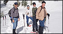 From alpine to desert, Outspire guides enrich your experience by giving context to your hike. So that your destination is not only what you see, but a sense of where the area fits in New Mexico's history, geology and natural world. Our hiking guides are experienced, enthusiastic, and motivated to share the joy of being outside! Day hikes and winter snowshoe outings are planned to suit your interests and fitness.
Helpful Links
Tour Companies
Outspire Hiking and Snowshoeing
- Santa Fe Area
- Snowshoeing, Hiking
- 505-660-0394
Details
Length:
7 miles
Difficulty:
Intermediate
Time:
3 - 4 hours
Trailhead Elevation:
10400
Elevation Range:
10300 feet to 10400
Elevation Change:
-100
Usage:
Heavy
Season:
Year Round
Useful Map(s):
USGS: Jarita Peak, Holman