


Contact Info
HC 68 Box 50
Mimbres, NM 88049
- Phone:
- 575-536-2250
Basics
- Length:
- 13.6 miles
- Difficulty:
- Intermediate
- Time:
- 8 - 9 hours
- Trailhead Elevation:
- 6800 feet
- Elevation Range:
- 6800 feet to 8600 feet
- Elevation Change:
- 1800 feet
- Usage:
- Moderate
- Season:
- Spring to Fall
Basic Directions
From Silver City go east on U.S. 180 about 6 miles then turn left on NM 152. Follow NM 152 about 15 miles then turn left on NM 35. Follow NM 35 about 17 miles and turn right on Forest Road 150. Follow FR 150 about 22 miles to Black Canyon Campground. The first 8 miles of FR 150 is a graded, graveled all weather road. Beyond this point the road turns to dirt with many rocky sections. A high clearance vehicle is recommended. In wet conditions four-wheel drive may be required. From Black Canyon Campground go two-tenths of a mile further and turn right at the 72 Trail Head sign. After going through the gate go four-tenths of a mile to the trail head.
Description
Black Canyon has exceptional wilderness values and wildlife habitat.Trail 72 is a gradual ascent up Black Canyon to Reeds Meadow near the crest of the Black Range where it connects with Continental Divide Trail 74. The trail passes through broad meadows bordered by stately Narrow-leaf Cottonwood, Gamble Oak and Ponderosa Pine. At the upper end these trees transition to mixed conifer and aspen forest. There are many stream crossings and hikers should be prepared to wade.
Trails 72, 74, and 75 can be connected to form a loop of about 33 miles which includes Reeds Peak and spectacular views of the Black Range. This scenic loop offers very pleasent hiking but springs on the crest may be unreliable in dry seasons and there is no water along the ridge on Continental Divide Trail 74. To complete this loop adequate water should be carried.
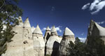
All along Trail 72 the broad open meadows, cliff formations, and a mix of cottonwood, oak, and conifer offer great scenic beauty and excellent opportunities for photography and wild life viewing.
Signs at the private property boundaries at the beginning of the trail must be obeyed and gates closed.
Details
Length:
Difficulty:
Time:
Trailhead Elevation:
Elevation Range:
Elevation Change:
Usage:
Season:
Useful Map(s):
Additional Details:
Rocky Canyon Campground has picnic tables, pit toilets, and ample parking for horse trailers. The trail head has very limited parking for a few vehicles and no facilities.
Silver City is 60 miles from the trail head and provides auto services, gas, groceries, lodging, medical facilities, restaurants, and shopping.
The stream in Black Canyon flows year around. Water quality is not tested therefore it cannot be guaranteed to be drinkable, it is advisable to filter or treat all drinking water.
Black Canyon''s diversity offers exceptional wildlife habitat for owls, hawks, turkey, and a great variety of songbirds. Deer, elk and bear are sometimes seen. The stream is home for the endangered Gila Trout and the fish dam constructed at Black Canyon Campground prevents other fish species from advancing up stream. Fishing isn''t permitted in these waters.
There are many inviting opportunities for camping all along the length of the canyon. To protect the habitat and wilderness qualities found here camping away from the stream in unused locations and practicing "leave no trace" camping techniques is recommended. Fuel stoves instead of fires are also recommended.


