




Contact Info
- Phone:
- 505-757-6121
Basics
- Length:
- 6 miles
- Difficulty:
- Easy,
Intermediate,
Difficult - Time:
- 4 - 5 hours
- Trailhead Elevation:
- 8000 feet
- Elevation Range:
- 8000 feet to 10199 feet
- Elevation Change:
- 2199 feet
- Usage:
- Moderate
- Season:
- Year Round
Basic Directions
Forest Road 79; Forest Road 375(4WD, high clearance)
Description
Starting from Forest Road 79, the section of trail to the descent into Apache Canyon is easy and generally wide. This trail segment is suitable for casual strolls through the woods. The trail becomes much steeper and more difficult as it descends into and climbs out of Apache Canyon. Bicyclists will probably have to walk some sections of trail. There are picnic tables and fire grates at the top of Glorieta Baldy.
Tour Companies
Outspire Hiking and Snowshoeing
- Santa Fe Area
- Snowshoeing, Hiking
- 505-660-0394
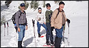 From alpine to desert, Outspire guides enrich your experience by giving context to your hike. So that your destination is not only what you see, but a sense of where the area fits in New Mexico's history, geology and natural world. Our hiking guides are experienced, enthusiastic, and motivated to share the joy of being outside! Day hikes and winter snowshoe outings are planned to suit your interests and fitness.
Helpful Links
Tour Companies
Outspire Hiking and Snowshoeing
- Santa Fe Area
- Snowshoeing, Hiking
- 505-660-0394
Details
Length:
Difficulty:
Intermediate
Difficult
Time:
Trailhead Elevation:
Elevation Range:
Elevation Change:
Usage:
Season:
Useful Map(s):
Additional Details:
There is no water between Apache Canyon and the top of Glorieta Baldy. Stream flows in Apache Canyon are intermittent. Bring all your water with you.
Do not cut switchbacks along these trails. The soils are highly susceptible to erosion.
Do not camp or build fires in Apache Canyon
Be prepared for severe weather and lightning any time of year. Carry extra layers and weather gear.