


Contact Info
1710 N. Riverside Drive
Española, NM 87532
- Phone:
- 505-753-7331
Basics
- Length:
- 10 miles
- Difficulty:
- Intermediate
- Time:
- 7 - 8 hours
- Trailhead Elevation:
- 7600 feet
- Elevation Range:
- 7600 feet to 10600 feet
- Elevation Change:
- 3000 feet
- Usage:
- Light
- Season:
- Year Round
Description
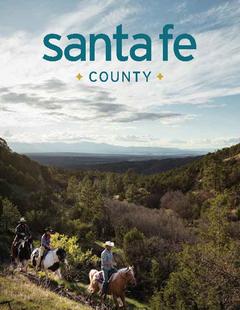
The Capulin Trail follows the Rio Capulin from its confluence with the Rio Nambe and Trail 160 at the trail’s western terminus, up past the Rio Capulin’s headwaters and then crosses a saddle and drops down into the upper Rio Frijoles, leaving the Frijoles at another saddle and then down to the Rio Medio and meets with Trail 155.
Starting from Rio Nambe, the trail follows the southern side of the Rio Capulin for about a mile before it reaches the grassy meadows of Rancho Viejo. This is privately owned ranching land. Leaving the private land, the trail crosses the river and continues up the northern bank of the Rio Capulin. After another two miles, a post is seen marking the intersection of 162 to the south, which follows the main branch of the Rio Capulin to it’s headwaters coming off of Santa Fe Baldy. Continue up Trail 158 to some switchbacks and the gradual ascent to the ridge and saddle separating the Capulin and Frijoles drainages. At the top of this ridge is the junction of seldom-used Trail 231. From here Trail 158 drops to the Rio Frijoles in a short half-mile. The Rio Frijoles must be forded at this point, and the river can be rather wide here.
The Rio Frijoles is crossed several times again within the next three miles. Soon you will pass a junction with Trail 6 to the north, which leads to Sierra Mosca. Open grassy meadows are featured through this section. Passing the junction with Trail 243 to the south, you soon come upon the Panchuela West cabin, a Forest Service administrative site. Shortly after the cabin, the trail begins to climb out of the canyon to the high point of this trail on the ridge at 10,600 feet in elevation. Continue past the junction with Trail 156 to the north, and from here the trail begins the long gradual descent to the Rio Medio.
Tour Companies
Outspire Hiking and Snowshoeing
- Santa Fe Area
- Snowshoeing, Hiking
- 505-660-0394
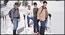 From alpine to desert, Outspire guides enrich your experience by giving context to your hike. So that your destination is not only what you see, but a sense of where the area fits in New Mexico's history, geology and natural world. Our hiking guides are experienced, enthusiastic, and motivated to share the joy of being outside! Day hikes and winter snowshoe outings are planned to suit your interests and fitness.
Helpful Links
Tour Companies
Outspire Hiking and Snowshoeing
- Santa Fe Area
- Snowshoeing, Hiking
- 505-660-0394
Details
Length:
Difficulty:
Time:
Trailhead Elevation:
Elevation Range:
Elevation Change:
Usage:
Season:
Useful Map(s):
Additional Details:
Major damage to Trail 158 has resulted from the Capulin Fire of 2003. As of summer 2003, portions of the trail between Rancho Viejo and the junction with Trail 162 may be impassable for those with stock. This area is scheduled for major trail reconstruction in the summer of 2004.
Map + Directions
Basic Directions
From the south, Trail 158 can be accessed most directly at Rancho Viejo by using the Borrego Trail 150 from the Aspen Ranch Trailhead 9. From the north, the trail can be reached from the Rio Medio Trail 155 from Trailhead 6 at Borrego Mesa.