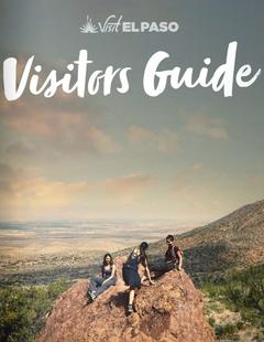


Basics
- Length:
- 110 miles (177 km)
- Time:
- 3 hours to drive, or 6-8 hours to visit this Byway
- Fees:
- There are no fees to drive the Byway.
Description
Traveling north from Silver City, the mountains and craggy bluffs rise to meet you. Stopping at the Continental Divide, the vistas extend to Mexico. The road winds through the old gold mining camp of Pinos Altos; its historic buildings offer a sense of stepping back in time. Along Bear Creek, water has sculpted the rock into intriguing shapes. Beneath thetowering rock formations, a tranquil valley can be seen along Cherry Creek. This was the heart of gold and silver mining in the 1860s. Now peaceful and pristine, the creek hosts bird life and butterflies.
The road winds through the forest; firs and ponderosa pines yield to pinyon and juniper. OnCopperas Peak the vast wild expanse of the Gila Wilderness lies before you. The volcanic history of this land is written in the scattered basalt, resembling towers and cities lost. You are seeing the land Aldo Leopold saw in 1924 and when he successfullyfought to preserve the first Wilderness area.
Leaving Copperas Vista, the road descends to the Forks of the Gila River, and the thermal kettle of Gila Hot Springs. In this pristine valley the ground water is thermal and hot springsabound. The rivers run through the valley to the junction of the main Gila River, at the NM-15 bridge. The Gila Cliff Dwellings National Monument sits in the head of a small canyon just off the West Fork. The Dwellings is one of the first National Monuments in the nation. You can step from the Byway many places along the route and experience unspoiled wilderness.
The Byway crosses the Continental Divide several times and is crossed by the Continental Divide Trail, a premier hiking experience. Continuing back to the junction of NM-15 and NM-35, one enters the Sapillo Valley, offering a variety of excellent bird life and wildlife viewing opportunities. At Lake Roberts, as many as ten hummingbird species visit the area, feeding on wildflowers along the creek. New Mexico's first designated State Birding Trail includes the Byway route and offers world class birding year-round.
Continuing on NM-35, the towering cliffs follow Sapillo Creek, yielding to grassy meadows. Entering the Mimbres Valley east of the Continental Divide, the scenery changes to smallfarms and ranches. The Mimbres River sweeps down from the Black Range; the Aldo Leopold Wilderness is visible to the east. Along the Mimbres River, bosques (Spanish for cottonwood groves) protect an abundance of wildlife and bird species. The trees guard water quality, hold the banks against flooding, and explode into gold in the fall. The towns of Mimbres and San Lorenzo still exist, each with rich settlement history, and each with a unique flavor of its own.
At the junction of NM-35 and NM-152, the traveler heads west to Silver City. An area of rough country, with prickly pear cactus and other varieties growing along the roadside, looms along the way. The great wealth of this part of the Byway is apparent as you pass the Santa Rita open pit copper mine. One of the largest mines in the country, it has been worked for two centuries and continues operations today.
Turning on to US-180 takes the traveler to historic Fort Bayard National Landmark. North of the fort is the nation's second largest Alligator juniper tree, known locally as "The Big Tree," and the Cameron Creek birding area. Heading back to Silver City completes the tour.
Tourism Resources
Helpful Links
Tourism Resources
Points of Interest
Points of Interest Along The Way
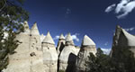
City of Rocks State Park (NM)
Over a million years ago a nearby volcano erupted tiny particlesof very hot rock. Instead of rising into the air they flowed fromthe lip of the volcano. When the flow came to rest, the particlesfused together to form the solid rock found in the City of Rocks,known technically as 'welded tuff.'
Doubtless, the tuff was covered later by other volcanicmaterial, but erosion acting through many thousands of yearsuncovered the tuff and attacked it. Because of its structure andcomposition, this rock scales off on the exposed surface.
Wind and water have carried off the volcanic debris, leavingthese rounded monumental forms as a spectacle of the wonders ofnature.
Continental Divide and Continental Divide Trail (NM)
The byway crosses the Continental Divide in several places, offeringstunningr views of Mexico to the south and the high mountainous heart of the Gila National Forest. The rugged Aldo Leopold Wilderness and thevolcanic Black Range are visible from the Mimbres Valley.
The Continental Divide Trail is acessible from the byway at twopoints and offers a beautiful 14 day hike into ponderosa pine woodlandsand high desert.
Forks of the Gila River (NM)
Proceeding from the crest of the mountains and descending into the valleybelow, the community of Gila Hot Springs comes into view. Gila HotSprings offers thermal springs and a store. The three forks of the GilaRiver converge in this area, where several forest campgounds can also befound. Dramatic views of the Gila Conglomerate cliffs and rockformations and huge cottonwoods lining the banks of the river, are alsoeasily viewable.
Fort Bayard (NM)
Recently designated a National Historic Landmark, Fort Bayard is a former 19th Century US Army post built to protect miners and settlers from Apache raids. A national cemetery and a wildlife refuge are colocated with the post. Nearby Cameron Creek offers excellent birding. A system of National Recreational Trails offer access to archeological rock art sites.
Gila Cliff Dwellings National Monument (NM)
Gila Cliff Dwellings National Monument offers a glimpse of the homes and lives of the people of the Mogollon culture who lived in the Gila Wilderness from the 1280s through the early 1300s. The surroundings probably look today very much like they did when the cliff dwellings were inhabited. It is surrounded by the Gila National Forest and lies at the edge of the Gila Wilderness, the nation's first designated wilderness area. This designation meansthat the wilderness character of the area will not be altered by the intrusion of roads or other evidence of human presence.
Gila Cliff Dwellings National Monument, containing 533 acres, was established on November 16, 1907. Administration of the monument was transferred from the U.S. Department of Agriculture to the U.S. Department of the Interior on August 10, 1933. In the spring of 1975, the National Park Service and the U.S. Forest Service signed a cooperative agreement whereby the Gila National Forest is responsible for administration of the monument.
Gila National Forest (NM)
The Gila National Forest has scenery ranging from high cool mountains with aspen and douglas fir to warm semi-arid lowlands with juniper, oak and cactus. Covering 3.3 million acres it is the sixth largest National Forest in the continental U.S.
Gila Wilderness (NM)
The Gila Wilderness, located 22 miles north of Silver City, New Mexico in the Gila National Forest, is precedent-setting as the first nationally designated wilderness in the US. The diversity of plant and animal species, many rare and endangered, can be found in areas of stark rock formations and post volcanic landscape as well as lush canyon bottoms. Visitors are drawn to the dark night skies and vast sweeps ofcountry where solitude can be found. The wilderness' extensive trail system provides a variety of hiking, backpacking, birding and horseback riding opportunities within a total land area of 558,065 acres.
Lake Roberts (NM)
Lake Roberts is a pristine mountain lake nestled in the pine-covered slopes of the nearby mountains. While it offers boating and fishing opportunties, its outstanding appeal is its distinction as home to hundreds of bird species and other wildlife. Bald eagles winter here and in summer thousands of hummingbirds nest here. At the peak of migration, as manyas 10 hummingbird species visit the area.
Mimbres (NM)
Crossing the Continental Divide, one enters the Mimbres Valley. The Mimbres River flows along the road, creating a linear oasis of cottonwood bosque winding past small ranches.Prehistoric Mimbres people lived along this river, and later the Apaches.
Hispanics and Anglos settled here as well, mining gold and silver from the hills, and leaving ghost towns and graveyards to mark their passing.
Pinos Altos (NM)
High above Silver City is the oldest historical site on theByway. The old gold camp of Pinos Altos with its historicbuildings, is perched astride the Continental Divide. Looking south you see the sweeping plains and mountains of Mexico. To the north, stunning views of rugged cliffs and mountains of the Gila National Forest abound.