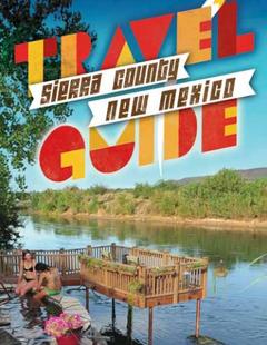


Contact Info
1710 N. Riverside Drive
Española, NM 87532
- Phone:
- 505-753-7331
Basics
- Length:
- 3 miles
- Difficulty:
- Intermediate
- Time:
- 2 - 3 hours
- Trailhead Elevation:
- 7400 feet
- Elevation Range:
- 7400 feet to 8800 feet
- Elevation Change:
- 1400 feet
- Usage:
- Heavy
- Season:
- Spring to Fall
Description
In order to reach the trail, walk up the service road and bear left through a green gate, passing the old Quemazon Nature Trail to the south. This was once a short loop trail with identified interpretive sites and signs, but was heavily damaged from the Cerro Grande Fire of 2000 (see below), and not much remains. Continue on the Quemazon Trail, which is a historic old road that once was a wagon road accessing what is now the Valle Caldera National Preserve. A bit less than a mile from the parking area is a short spur to the south; this side trail leads to the edge of the Los Alamos Canyon and a site called Cave of the Winds.
The Quemazon Trail continues to the northeast along the canyon edge, and many old wagon ruts can still be seen worn into the soft volcanic tuff. The trail will pass a junction, now difficult to see, with the old Knapp Trail which once was a steep and difficult route back down into Los Alamos Canyon; this trail is now nearly obliterated by the fire. Eventually the Quemazon Trail will intersect with the Pipeline Road, a rough four wheel drive road that is now closed to motorized use. This road connects the town to the Valles Caldera National Preserve, and several different loop routes are possible. The Quemazon Trail remains a very popular biking and hiking trail.
Tour Companies
Outspire Hiking and Snowshoeing
- Santa Fe Area
- Snowshoeing, Hiking
- 505-660-0394
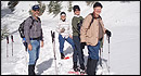 From alpine to desert, Outspire guides enrich your experience by giving context to your hike. So that your destination is not only what you see, but a sense of where the area fits in New Mexico's history, geology and natural world. Our hiking guides are experienced, enthusiastic, and motivated to share the joy of being outside! Day hikes and winter snowshoe outings are planned to suit your interests and fitness.
Helpful Links
Tour Companies
Outspire Hiking and Snowshoeing
- Santa Fe Area
- Snowshoeing, Hiking
- 505-660-0394
Details
Length:
Difficulty:
Time:
Trailhead Elevation:
Elevation Range:
Elevation Change:
Usage:
Season:
Useful Map(s):
Additional Details:
This trail, like many in the Los Alamos area, is at least partially within the area burned by the Cerro Grande Fire of 2000. The trail has suffered severe damage in some places, and trail rehabilitation efforts have failed to fully restore the trail to pre-fire conditions.
Visitors should be aware of dangers and hazards in the burned area. In particular, recreation in the burned area should be avoided during windy days and during rainstorms due to the danger of flash floods and falling trees.
Map + Directions
Basic Directions
The Quemazon trailhead is adjacent to two water tanks off of 48th Street in Los Alamos. Follow Trinity Drive west, crossing Diamond Drive to 48th Street. Turn left onto Sandia Drive and then immediately turn left again. A sign on the right side of the road marks the trailhead and the parking area.