


Contact Info
1710 N. Riverside Drive
Española, NM 87532
- Phone:
- 505-753-7331
Basics
- Length:
- 17 miles
- Difficulty:
- Difficult
- Time:
- 9 - 11 hours
- Trailhead Elevation:
- 8000 feet
- Elevation Range:
- 8000 feet to 9800 feet
- Elevation Change:
- 1800 feet
- Usage:
- Light
- Season:
- Year Round
Description
Starting from the grassy meadows of Aspen Ranch, follow the road 100 yards to the north, and just before you reach a locked gate the trail will branch off to the west. At this point the Borrego Trail 150 and the Rio en Medio Trail 163 piggyback on top of each other for a short distance. The trail will wind around some private land and drop down to and cross the Rio en Medio. Follow the Rio en Medio downstream for a short distance and you will see a junction to the north. This is where the Borrego trail leaves the Rio en Medio Trail, and follow the Borrego Trail back up to the road you had been following earlier. Continue north along the road for 1/4 mile and you will see the Borrego Trail junction off of the road and continue to the north.
From here the trail begins a gradual descent down a side canyon to the Rio Nambe. After crossing to the north side of the Rio Nambe, proceed about a quarter mile up the canyon and look to the north for a sign post marking the continuation of the Borrego Trail. From here the trail will climb over the pass separating the Rio Nambe drainage and the Rio Capulin drainage. After dropping down to the Rio Capulin, cross to the north side, go downstream a little bit and look for the trail continuing north. After another pass the trail begins the descent down to the Rio Frijoles. Cross to the north side of the Rio Frijoles, proceed upstream for a few hundred yards and look for the trail heading north up the hillside. The trail climbs up to another pass above Agua Sarca Canyon and then descends into the Rito Gallina Canyon. Here the trail levels off quite a bit and descends gradually to the Rio Medio. This river can be quite substantial at this point, and fording it may be a challenge, especially during the peak runoff time in early spring.
After crossing the Rio Medio, there is only a short climb out of the canyon to an old road- turn right and follow the road to the east and the Borrego Trailhead 8 at Borrego Mesa.
Tour Companies
Outspire Hiking and Snowshoeing
- Santa Fe Area
- Snowshoeing, Hiking
- 505-660-0394
 From alpine to desert, Outspire guides enrich your experience by giving context to your hike. So that your destination is not only what you see, but a sense of where the area fits in New Mexico's history, geology and natural world. Our hiking guides are experienced, enthusiastic, and motivated to share the joy of being outside! Day hikes and winter snowshoe outings are planned to suit your interests and fitness.
Helpful Links
Tour Companies
Outspire Hiking and Snowshoeing
- Santa Fe Area
- Snowshoeing, Hiking
- 505-660-0394
Details
Length:
Difficulty:
Time:
Trailhead Elevation:
Elevation Range:
Elevation Change:
Usage:
Season:
Useful Map(s):
Additional Details:
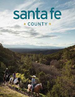
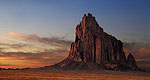
The Borrego Trail is part of the historic route used by the early Spanish settlers to drive sheep from the northern villages to Santa Fe. It heads almost continually north, climbing in and out of four different canyons. The country through which it passes is rugged and the trail encounters little level terrain.
The elevation is lower here than in the higher country of the central Pecos, and it is also dryer and warmer.
Map + Directions
Basic Directions
Aspen Ranch Trailhead 9 can be approached most easily from State Highway 475 out of Santa Fe. This is the road to the Santa Fe Ski Area. Just after the Big Tesuque Campground, take a left turn on Forest Road 102 (Pacheco Canyon Road), a dirt road that is suitable for passenger cars. Follow FR 102 to a T junction, turn right on Forest Road 412, and follow FR 412 to Aspen Ranch Trailhead 9, parking near the information kiosk.
An alternative is to start the trail from the north end; in that case take State Highway 503 north past Cundiyo, and just after you pass the road to Santa Cruz Lake on your left, you will see Forest Road 306. Turn right on FR 306 and follow 7 miles to the turnoff to Trailhead 8. Follow this dirt road .6 miles to the trailhead, and park You will hike along the small dirt road to the west for about a ¼ mile, and the trail will junction to the south. This area is quite remote, and the incidents of vandalism are slightly higher than at the more popular Aspen Ranch Trailhead 9.