


Contact Info
1710 N. Riverside Drive
Española, NM 87532
- Phone:
- 505-753-7331
Basics
- Length:
- 8 miles
- Difficulty:
- Difficult
- Time:
- 7 - 8 hours
- Trailhead Elevation:
- 9120 feet
- Elevation Range:
- 9120 feet to 11700 feet
- Elevation Change:
- 2580 feet
- Usage:
- Light
- Season:
- Spring to Fall
Description
This trail is somewhat isolated, remote and little used. Not all junctions are well signed and the trail can be hard to follow. At the point where the Borrego Trail 150 crosses the Rito Gallina Trail 228, there is an option of traveling east, farther into the Pecos Wilderness, or west out of the Wilderness. The section of the Rito Gallina Trail to the west that climbs out of the wilderness soon turns into an old jeep road. This old roaded section connects with another old roaded section of the Sierra Mosca Trail 156, west of the Pecos Wilderness and continues off towards a private land grant.
However, turning east onto the Rito Gallina Trail will take one deeper into the heart of the western Pecos. As the trail climbs up a low ridge and continues east above the Agua Sarca River you soon come upon the old Agua Sarca cabin. Beyond this cabin the trail diminishes, and finding and following the trail becomes much more challenging. Generally the trail continues east up the Agua Sarca drainage. When the terrain becomes considerably steeper, the trail will swing to the north, contrary to what is shown on some maps, and follow a ridge to the north of the drainage. The trail soon swings south again and intersects one of several springs marking the headwaters of the Agua Sarca River.
From here the trail switchbacks up the slope to a flat grassy mesa just southwest of Cienega Redonda. The trail is easily lost here, but if the visitor follows the ridge to the north and drops down slightly to the west, the open meadow of Cienega Redonda will be encountered. A trail sign marks the intersection of Trail 6 and the continuation of Trail 228. An old cabin can be seen just below the trail sign. Trail 228 continues to the northeast and skirts the side of Sierra Mosca, one of the highest timbered peaks in the Pecos. Passing the junction with Rio Molino Trail 227, the Rito Gallina Trail continues around the side of the mountain, and then heads north again and drops down to a grassy saddle. From here the trail crosses several grassy meadows where the trail tread may be difficult to find and follow. The trail finally emerges on the flat grassy mesa of Cienega Pajarito and terminates at the junction with Sierra Mosca Trail 156, with fine views opening up in all directions.
Tour Companies
Outspire Hiking and Snowshoeing
- Santa Fe Area
- Snowshoeing, Hiking
- 505-660-0394
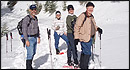 From alpine to desert, Outspire guides enrich your experience by giving context to your hike. So that your destination is not only what you see, but a sense of where the area fits in New Mexico's history, geology and natural world. Our hiking guides are experienced, enthusiastic, and motivated to share the joy of being outside! Day hikes and winter snowshoe outings are planned to suit your interests and fitness.
Helpful Links
Tour Companies
Outspire Hiking and Snowshoeing
- Santa Fe Area
- Snowshoeing, Hiking
- 505-660-0394
Details
Length:
Difficulty:
Time:
Trailhead Elevation:
Elevation Range:
Elevation Change:
Usage:
Season:
Useful Map(s):
Map + Directions
Basic Directions
Closest access to this trail is from the Borrego Trail 150, from Borrego Mesa. Take NM 503 north from Cundiyo to Forest Road 306 and follow seven miles to the turn off for Borrego Trail 150. Follow Trail 150 south across the Rio Medio and up to the headwaters of the Rito Gallina and a saddle separating the Gallina and Agua Sarca drainages, where you will find the junction with Trail 228.