


Basics
- Length:
- 163 miles (262 km)
- Time:
- 2.5 to 3 hours to drive, or a full day to see the entire Byway.
- Fees:
- There may be area use or special attraction fees along the Byway.
Description
The Jemez Mountain Trail will take you from Albuquerque to Santa Fe via Bernalillo, a variety of Spanish and Indian ruins, the Coronado and Jemez State Monuments, Los Alamos, and the Bandelier National Monument. From this monument, it is just a short jaunt to either Chimayo and El Santuario de Chimayo, or to "The City Different," Santa Fe.
Just north of Albuquerque, at the unspoiled village of San Ysidro on the junction of US 550 and NM 4, quietly begins the Jemez Mountain Trail. Traveling this route is a journey through time. A leisurely day trip takes you past fantastic geologic formations, ancient Indian ruins and Indian pueblos, and reminders of the area's logging, mining, and ranching heritage. Approximately 65 miles of the Byway winds through the Santa Fe National Forest and 40 miles of this are now the Jemez National Recreation Area. Take the many opportunities to hike, fish, camp, and, in the winter, cross-country ski. The Jemez Mountains are also famous for their natural hot springs.
San Ysidro, Upper Sonoran desert terrain, is a village where you can find the work of local artisans and view the restored Spanish adobe church.
Jemez Pueblo is about five miles from San Ysidro, located at the gateway of the majestic Cañon de San Diego. There are over 3,000 tribal members, most of whom reside in a single Puebloan village known as Walatowa - the Towa word meaning "This is THE place." Enjoy traditional Jemez foods, and arts and crafts available at roadside stands in the beautiful Red Rocks area. Jemez Pueblo has recreation areas where you can picnic, fish, and enjoy the great outdoors.
Tourism Resources
Helpful Links
Tourism Resources
Points of Interest
Points of Interest Along The Way
Albuquerque (NM)
In 1706, Albuquerque was founded by a group of colonists who hadbeen granted permission by King Philip of Spain to establish a newvilla (city) on the banks of the Rio Grande (which means big orgreat river). The colonists chose a place along the river where itmakes a wide curve providing good irrigation for crops and a sourceof wood from the bosque and nearby mountains.
The growth of Albuquerque can be traced to two changes duringthe early development to the area. First, the Rio Grande movedfurther west causing a slight shift in the population. Second, therailroad came to Albuquerque in 1880, and a "New Town"
grewup along the tracks two miles east of Old Town. Populationincreases can also be attributed to Albuquerque becoming animportant stop on the Santa Fe Trail and the Camino Real.
Albuquerque never went through the lawless days of the frontieras did other western towns. When those times came (during the lastquarter of the 19th Century), Albuquerque already had anestablished culture a century-and-a-half old. Much of Albuquerque'sappeal today can be attributed to the subtle blending of the manycultures that comprise its fabric: American Indian, Spanish, Anglo,African, and Asian. Each left its mark in food, music, religion,art, customs, architecture, and traditions.
Directions
Located at the intersections of I-25 and I-40.
Bandelier National Monument (NM)
Best known for mesas, sheer-walled canyons, and the ancestral Pueblo dwellings found among them, Bandelier also includes over 23,000 acres of designated wilderness. It was named for Adolph Bandelier, a 19th Century anthropologist.
Directions
The Monument is located northwest of Santa Fe and just south of the Jemez Mountain Trail. On Interstate 25 take second Santa Fe exit (St. Francis) to 84/285 West. Follow signs to Bandelier at every major junction.
Bradbury Science Museum (NM)
The Bradbury Science Museum is located in downtown Los Alamos, New Mexico, the home of Los Alamos National Laboratory. The Museum serves as a bridge between the Laboratory and the community, helping to improve science education and science literacy. The Museum also serves as a window to the Laboratory, interpreting the Laboratory's history and current research.
Cabezon (NM)
Cabezon is a classic. A lot still remains, but unfortunately, it is located on private property with numerous no trespassing signs posted.
The village was started in the 1870s as the focal point for farming and raising sheep. It was also a stage stop between Santa Fe and the military outpost at Fort Wingate. It quickly grew with the mandatory saloons, blacksmith shop, stores, and the like. Richard Heller ran the Heller Store and post office for a good many years. Mr Heller was the prominent Cabezon citizen of the day - he was a large producer of sheep and cattle, as well as his retail business.
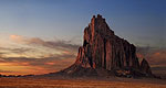
Cabezon flourished until the 1940s. Mr. Heller died in 1947, and the Rio Puerco dried up. The post office officially closed in 1949. Much still remains, and one can still get a good look at it behind the fence. The site sits at the base of Cabezon Peak - visible for miles.
--Paul Lessard--
Directions
Cabezon is about 10 miles west of the Byway near the Rio Puerco.
Ellis Museum of Anthropology (NM)
Part of the Ghost Ranch Museums, the Ellis Museum houses wonderful archaeological treasures.
Directions
The museum is north of the Byway at Ghost Ranch along Hwy 84 in Abiquiu.
Ghost Ranch Piedra Lumbre Education and Visitor Center (NM)
Ghost Ranch Piedra Lumbre Education and Visitor Center, newly reopened through a Forest Service permit, features exhibits on the geology, paleontology and archeology of this region of. It also contains a number of exhibits focused on the culture, history, and traditions of Northern New Mexico.
The facility first opened in 1959, and it was originally designed by William Carr and Arthur Pack, both of whom were early conservationists. The museum was donated to the U.S. Forest Service in the 1970s in hopes of preserving it. At one point, the museum housed rescued animals that could not be returned to the wild.
In the Visitor Center, you will find exhibits such as the Aspen Exhibit and the Traveling Exhibitions Gallery, which includes exhibits from the New Mexico Museum of Natural History and Science.
Directions
Ghost Ranch is located north of the Byway, 15 miles north of Abiquiu, along Hwy 84.
Jemez Springs Bath House (NM)
Since its re-opening in 1993, the Jemez Springs Bath House has become an insider's secret, popular with New Mexicans, celebrities, and spa enthusiasts from all over the world. Off the beaten path of the Albuquerque, Santa Fe and Taos tourist centers, this historic mineral bath house is one of the best excuses for a visit to the Jemez Mountains and some of the most beautiful landscapes in the Southwest.
The bath house is well maintained but retains its historic charm. The decor is country Victorian, and the atmosphere is small town friendly and relaxed. Every effort has been made to avoid the "institutional" feel of larger facilities. There are only eight large concrete, individual tubs, each privately curtained. An outdoor cedar tub is available for groups of up to six. Both the baths and the outdoor tub are filled with 100% mineral water using a combination of hot water directly from the spring (at 154 to 186 degrees Fahrenheit) and water that has been cooled in large outdoor tanks next to the bath house.
Jemez State Monument (NM)
Jemez State Monument consists of the ruins of an ancient puebloof the Jemez people known as Giusewa and the ruins of a 17thCentury Spanish Mission known as San Jose de los Jemez. The missionhad a unique octagonal-shaped bell tower. There is a museum andsigned trail at the Monument, which is part of New Mexico StateMonuments.
The pueblo was first built in the AD 1500s by ancestors of themodern residents of Jemez Pueblo. The Jemez people lived a typicalSouthwestern lifestyle for that time. They raised corn, beans andsquash in Jemez Canyon along the Jemez River and also up on thenearby mesas. They hunted deer, rabbits, elk, and other game fromthe forests. They had plenty of water from the Jemez River and hotsprings nearby. In the best of times, they may have had a somewhatidyllic life, but the climate could be fickle.
The Jemez people built a small pueblo at first, and thengradually enlarged it to a few hundred rooms. As many as a hundredfamilies may have lived there at one time. Scattered about thecanyons and mesas in this area were dozens of other Jemez villages,some of which had thousands of rooms and hundreds of familiesliving there. A central feature at all the Jemez villages was thekiva. There were usually several of these features at the largervillages, and the very largest villages had a huge kiva knownconventionally as a "great" kiva. Kivas were round subterraneanstructures, roofed over with logs and earth and entered by a laddernear the center of the roof. Kivas were sacred spaces whereceremonies and rituals were performed. Giusewa had several kivasand two are visible today.
In 1540 the first organized Spanish exploration,the CoronadoExpedition, reached New Mexico. Neither Coronado nor his menreached the Jemez area. Other explorers also came and went, but in1598 a Spanish colonizing party under Don Juan de Onate came to NewMexico to stay. By 1609, a priest had been assigned to the Jemez,and a few years later work began on a mission building at Giusewa.The building was complete by 1621 and was known as San Jose de losJemez. A convento, or convent, was also built to housethe priests and other religious figures.
The Jemez people living at Giusewa had a spiritual crisis whenthey were asked to convert to Catholicism. San Jose de los Jemezwas burned and the pueblo was abandoned for some time. It was laterre-occupied, but was abandoned for good by the Jemez by 1700. In1680, all the Pueblo peoples of New Mexico united and drove theSpaniards completely out of New Mexico. In 1692, the Spaniards cameback and easily reconquered the Natives because of their lack ofunity. In 1706 the Jemez people rebuilt an old village of theirsfurther down Jemez Canyon, which became the village known today asJemez Pueblo, or Walatowa in the native language.
New Mexico remained a Spanish colony until 1825, and then aMexican province following Mexican independence. In 1846, theUnited States took possession of New Mexico from Mexico during theMexican War, and in 1848, New Mexico became a US Territory. NewMexico became a state in 1912.
Archaeologists excavated Giusewa and San Jose Mission beginningin earnest by 1921. The early work was under the direction ofLansing Bloom and others. The work was continued into the 1930s bythe University of New Mexico and resulted in the completeexcavation of the mission and convent and of many rooms in thepueblo, along with several kivas. A number of unique artifacts wererecovered during the excavations.
--Micheal Elliot--
La Bajada Ghost Town (NM)
La Bajada dates back to the 1680s when it was inhabited by people from what is now across the border. Later, and for many years, the town served as a vital stopping point for stages, freight wagons and then automobiles after the harrowing hairpin descent from La Bajada Hill. The road, which was replaced in 1932, was along the route of the old Santa Fe Trail, which linked Santa Fe and Albuquerque. Most of the residents moved away in the early 1940s to seek a way of life other than farming. One of the most interesting ruins at La Bajada is the melting adobe shell of the Catholic Church and beside it the wooden fences and crosses of long-neglected graves.
--Courtesy of Henry Chenoweth.
McCauley Hot Springs (NM)
McCauley Hot Spring is perhaps one of the best-kept local secrets. After a short hike in the woods, hot spring enthusiasts are greeted by large hot spring pools located in a high mountain meadow.


