


Contact Info
1710 N. Riverside Drive
Española, NM 87532
- Phone:
- 505-753-7331
Basics
- Length:
- 2 miles
- Difficulty:
- Easy
- Time:
- 1 to 1-1/2 hrs
- Trailhead Elevation:
- 9000 feet
- Elevation Range:
- 9000 feet to 9650 feet
- Elevation Change:
- 650 feet
- Usage:
- Heavy
- Season:
- Year Round
Description
This section of the Guaje Canyon Trail is an old forest road now closed to motorized vehicles, and is in excellent condition. From Camp May Road, the trail curves northward through mixed conifer forest along the side of a ridge and ascends slightly for approximately three-quarters of a mile. It soon passes a junction with the popular Pajarito Nordic Ski Trail, and then drops down into the Cañada Bonito grassland, a research natural area.
The trail borders the research natural area for one mile, and then ascends a low ridge marking the actual rim of the extinct volcanic caldera as it approaches the boundary with the Valles Caldera National Preserve. The trail then descends through stands of aspen and fir to Pipeline Road, where signs mark the continuation of the trail.
Tour Companies
Outspire Hiking and Snowshoeing
- Santa Fe Area
- Snowshoeing, Hiking
- 505-660-0394
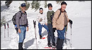 From alpine to desert, Outspire guides enrich your experience by giving context to your hike. So that your destination is not only what you see, but a sense of where the area fits in New Mexico's history, geology and natural world. Our hiking guides are experienced, enthusiastic, and motivated to share the joy of being outside! Day hikes and winter snowshoe outings are planned to suit your interests and fitness.
Helpful Links
Tour Companies
Outspire Hiking and Snowshoeing
- Santa Fe Area
- Snowshoeing, Hiking
- 505-660-0394
Details
Length:
Difficulty:
Time:
Trailhead Elevation:
Elevation Range:
Elevation Change:
Usage:
Season:
Useful Map(s):
Additional Details:
The first section of Guaje Canyon Trail passes beside Cañada Bonito research natural area, a high elevation Thurber fescue community. The trail winds through waist-high grasses outside the boundary of the research area, which is set aside solely for research and educational purposes. Cañada Bonito is unique in that it is one of very few high mountain grasslands in the area, which has not been subjected to livestock grazing since 1943. the grassland is closed to the public with the establishment of the nuclear laboratory in Los Alamos, while other mountain grasslands in the area have been heavily grazed. Hikers and bikers should take special care to stay on the trail to protect the natural resource. Cañada Bonito is only the first section of the Guaje Canyon Trail, which extends eastward past Guaje Reservoir to Upper Guaje Road (FR 422).
Map + Directions
Basic Directions
This section of the Guaje Canyon Trail 282 is best reached by way of the Camp May Road (FR 1), which travels northwest from Highway 501 approximately one and a half miles west of Los Alamos. The trailhead is a quarter of a mile below Camp May, just beyond the large ski area parking lot. The trail, formerly a forest road, starts just north of Camp May Road.

.jpg)


