


Contact Info
- Phone:
- 505-783-4774
Basics
- Location:
- South of Grants
- Type:
- Monument-Building
- Price:
- Free
Description
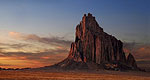
The richly diverse volcanic landscape of El Malpais offers solitude, recreation, and discovery. Explore cinder cones, lava tube caves, sandstone bluffs, and hiking trails. Wildlife abounds in the open grasslands and forests. While some may see a desolate environment, people have been adapting to and living in this extraordinary terrain for generations. Come discover the land of fire and ice!
Hours + Fees
Hours:
Season:
Price:
Price Details:
Map + Directions
Basic Directions
El Malpais is located south of Grants, NM. Two major state highways border the monument and conservation area and both are accessed via Interstate 40. Exit 89, east of Grants, will take you along NM 117 which forms the eastern boundary. BLM’‘s El Malpais Ranger Station is located 9 miles south of this exit and is open daily. Exit 85 at Grants will take you to the Northwest New Mexico Visitor Center, a multi-agency facility, located south of exit 85 and is open daily. Exit 81, west of Grants, will take you along NM 53 which forms the northwestern boundary. NPS’‘s El Malpais Information Center is located 23 miles south of this exit and is open daily.


