


Contact Info
1710 N. Riverside Drive
Española, NM 87532
- Phone:
- 505-753-7331
Basics
- Length:
- 2 miles
- Difficulty:
- Difficult
- Time:
- 1.5 - 2.5 hours
- Trailhead Elevation:
- 10000 feet
- Elevation Range:
- 10000 feet to 11500 feet
- Elevation Change:
- 1500 feet
- Usage:
- Light
- Season:
- Spring to Fall
Description
The trail begins the steep ascent out of the Frijoles drainage immediately and climbs to the top of a ridge within the first quarter mile. From here the trail levels out slightly, but continues to climb along the side of a small drainage for another half mile. A small stream is soon encountered with the trail following the stream up along one side or the other. The terrain soon opens up into a large boggy meadow with the trail skirting the northwest edge. Within another quarter mile, the trail opens up into the large grassy meadow of Cienega Redonda. The remains of an old cabin can be seen at the lower end of this meadow. Fifty yards uphill from the cabin, a trail sign marks the intersection of Agua Sarca Trail and the trail to Cienega Pajarito. The trail to Agua Sarca is very lightly used and is difficult to find and follow. The trail to Cienega Pajarito is more obvious, but can disappear occasionally in open grassy meadows.
Tour Companies
Outspire Hiking and Snowshoeing
- Santa Fe Area
- Snowshoeing, Hiking
- 505-660-0394
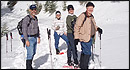 From alpine to desert, Outspire guides enrich your experience by giving context to your hike. So that your destination is not only what you see, but a sense of where the area fits in New Mexico's history, geology and natural world. Our hiking guides are experienced, enthusiastic, and motivated to share the joy of being outside! Day hikes and winter snowshoe outings are planned to suit your interests and fitness.
Helpful Links
Tour Companies
Outspire Hiking and Snowshoeing
- Santa Fe Area
- Snowshoeing, Hiking
- 505-660-0394
Details
Length:
Difficulty:
Time:
Trailhead Elevation:
Elevation Range:
Elevation Change:
Usage:
Season:
Useful Map(s):
Additional Details:
This hike takes about 1.25 hours. The turn-off occurs on the north side of the Rio Frijoles, along Trail 158 in the middle of the wide grassy pastures of Panchuela West. The trail intersection is not signed and visitors must be alert to look for a side trail heading up the grassy slope to the west. A small stream flows down a drainage just to the north of the trail.
Map + Directions
Basic Directions
Trail 6 access is easiest from the Rio Capulin Trail 158, about one mile west of the Panchuela West cabin


